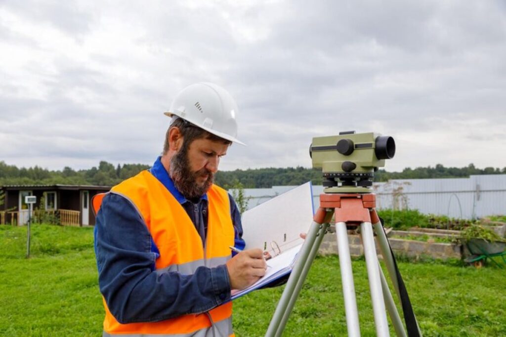
The intricate world of property ownership and land management relies heavily on the expertise of cadastral surveyors. These professionals play a pivotal role in defining property boundaries, ensuring that land ownership is accurately recorded and disputes are minimised. Understanding the responsibilities and processes involved in cadastral surveying is essential for anyone involved in real estate, land development, or property management.
Understanding Cadastral Surveying
Cadastral surveying is a specialised field of surveying that focuses on the legal boundaries of land parcels. It involves the precise measurement and mapping of land, which is crucial for establishing legal property rights. Cadastral surveyors are responsible for creating detailed maps and records that define the dimensions and location of properties, which are then used in legal documents and land registries.
The history of cadastral surveying dates back centuries, with its origins in the need for accurate land records for taxation and ownership purposes. Today, cadastral surveyor utilise advanced technology and methodologies to ensure precision and reliability in their work. This includes the use of GPS, laser scanning, and computer-aided design (CAD) software, which have revolutionised the way surveys are conducted.
In addition to technical skills, cadastral surveyors must have a thorough understanding of legal principles related to land ownership. They work closely with legal professionals to ensure that property boundaries are legally binding and comply with local regulations. This requires a deep knowledge of land law, as well as the ability to interpret and apply legal descriptions and documents.
The Responsibilities of a Cadastral Surveyor
Defining Property Boundaries
One of the primary responsibilities of a cadastral surveyor is to define and mark property boundaries. This involves conducting field surveys to measure and map the land, using a combination of traditional techniques and modern technology. Surveyors must ensure that their measurements are accurate and consistent with existing records, which often requires cross-referencing with historical maps and documents.
Once the survey is complete, the cadastral surveyor prepares a detailed report that includes maps, diagrams, and legal descriptions of the property boundaries. This report is used to update land registries and is essential for property transactions, development projects, and resolving boundary disputes. The accuracy and reliability of these reports are critical, as they form the basis for legal property rights.
Resolving Boundary Disputes
Boundary disputes can arise for a variety of reasons, including unclear or outdated property descriptions, encroachments, or conflicting claims of ownership. Cadastral surveyors play a crucial role in resolving these disputes by providing expert analysis and evidence. They conduct thorough investigations to determine the true boundaries of a property, often working alongside legal professionals and mediators to reach a resolution.
The process of resolving boundary disputes can be complex and time-consuming, requiring a combination of technical expertise and negotiation skills. Cadastral surveyors must be able to interpret historical records, assess physical evidence on the ground, and provide clear and concise reports that can be used in legal proceedings. Their work is essential in ensuring that property rights are upheld and that disputes are resolved fairly and efficiently.
Supporting Land Development and Planning
Cadastral surveyors also play a vital role in land development and planning. They provide essential data and analysis that informs the design and layout of new developments, ensuring that they comply with zoning regulations and land use policies. Surveyors work closely with architects, engineers, and planners to create accurate site plans and ensure that developments are built within legal boundaries.
Their expertise is also crucial in the subdivision of land, where existing parcels are divided into smaller lots for sale or development. Cadastral surveyors ensure that these subdivisions are accurately measured and legally defined, preventing future disputes and ensuring compliance with local regulations. Their work is essential in facilitating sustainable and orderly development, contributing to the growth and prosperity of communities.
The Tools and Techniques of Cadastral Surveying
Modern Technology in Surveying
Advancements in technology have transformed the field of cadastral surveying, making it more efficient and accurate than ever before. One of the most significant developments is the use of Global Positioning System (GPS) technology, which allows surveyors to determine precise locations with a high degree of accuracy. GPS is particularly useful in remote or difficult-to-access areas, where traditional surveying methods may be challenging to implement.
In addition to GPS, laser scanning technology is increasingly being used in cadastral surveying. Laser scanners can quickly capture detailed three-dimensional data of the land, providing surveyors with a comprehensive view of the terrain. This data can be used to create highly accurate maps and models, which are invaluable in defining property boundaries and planning developments.

Traditional Surveying Techniques
Despite the advancements in technology, traditional surveying techniques remain an essential part of cadastral surveying. These methods, which include the use of theodolites, total stations, and levels, provide a reliable means of measuring angles and distances on the ground. Surveyors often use a combination of traditional and modern techniques to ensure the highest level of accuracy and reliability in their work.
Traditional surveying techniques require a high level of skill and expertise, as surveyors must be able to interpret and apply complex mathematical principles. They must also be familiar with the use of various surveying instruments and be able to adapt their methods to suit different terrains and conditions. This combination of technical knowledge and practical experience is essential in producing accurate and reliable survey results.
See Also : Why a Contour Survey is Essential for Construction Projects
The Importance of Cadastral Surveying in Real Estate
Ensuring Legal Compliance
Cadastral surveying is essential in ensuring that property transactions and developments comply with legal requirements. Accurate property boundaries are crucial in preventing disputes and ensuring that land is used in accordance with zoning regulations and land use policies. Surveyors provide the necessary documentation and evidence to support legal processes, ensuring that property rights are protected and upheld.
Without accurate cadastral surveys, property transactions could be fraught with uncertainty and risk, leading to potential legal disputes and financial losses. Surveyors provide the assurance that property boundaries are accurately defined and legally binding, giving property owners and developers the confidence to proceed with their plans.
Facilitating Property Transactions
The role of cadastral surveyors is also vital in facilitating property transactions. Whether buying, selling, or leasing property, accurate boundary information is essential in determining the value and suitability of the land. Surveyors provide detailed reports and maps that are used in property appraisals, negotiations, and legal agreements, ensuring that all parties have a clear understanding of the property’s boundaries and dimensions.
Their work is particularly important in complex transactions involving multiple parcels of land or properties with unclear or disputed boundaries. Cadastral surveyors provide the expertise and evidence needed to resolve these issues, ensuring that transactions proceed smoothly and without unnecessary delays or complications.

Conclusion
The role of a cadastral surveyor is indispensable in the world of property and land management. Their expertise in defining property boundaries, resolving disputes, and supporting land development is crucial in ensuring that property rights are protected and that land is used efficiently and sustainably. As technology continues to advance, the work of cadastral surveyors will remain at the forefront of land management, providing the accuracy and reliability needed in an ever-changing landscape.

